Understanding how to correctly interpret soils is a cornerstone of successful site evaluation and development. This process, vital for engineers, agriculturists, and environmental scientists, hinges on the accurate observation and assessment of soil texture, color, and other physical properties. Particularly in regions like Florida, with its unique sandy soils, grasping the nuances of soil interpretation can significantly impact water management and effluent treatment strategies. The methodology developed by the USDA Natural Resources Conservation Service (NRCS) offers a comprehensive framework for this purpose, blending scientific rigor with practical insights to guide soil evaluation processes.
Understanding Soil Texture
Soil texture refers to the proportion of sand, silt, and clay particles in a soil sample. This characteristic is not just a measure of the soil’s feel but a direct indicator of its water retention capacity, aeration, and nutrient management abilities. The NRCS methodology employs a tactile analysis, supplemented by hydrometer and pipette methods, to classify soil textures accurately. In Florida’s context, where sandy soils predominate, understanding texture is crucial. Sandy soils, with their large particles and significant spaces, allow for rapid water passage. This characteristic has profound implications for effluent treatment, necessitating tailored strategies to prevent contamination of groundwater.

Soil Colors and Their Meanings
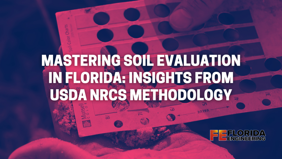
Soil color, often overlooked in casual observation, is a rich source of information about soil health and composition. Colors in soil result from the presence of organic matter, minerals, and varying degrees of wetness. The NRCS uses the Munsell Soil Color Charts to standardize color identification, enabling precise communication about soil properties. For instance, dark brown or black soils are typically rich in organic matter, while red or yellow soils might indicate iron oxide content. In Florida, the contrast in soil color can reveal differences in drainage patterns and organic content, essential for determining suitable land uses and management practices.

Florida’s Sandy Soils
The sandy soils of Florida present unique challenges and opportunities for soil interpretation. Their rapid drainage capacity, while beneficial for preventing waterlogging, raises concerns for effluent treatment. Traditional septic systems may not function optimally in such textures, highlighting the need for innovative wastewater management solutions. Moreover, the sandy texture influences the choice of crops and vegetation, as water and nutrient requirements differ from those of more clay-heavy soils.
Observing Onsite Vegetation
Onsite vegetation offers valuable clues about the underlying soil type. Plants with deep root systems might suggest well-drained, sandy soils, whereas vegetation that thrives in wet conditions could indicate clay-rich, moisture-retentive soils. This observational method, part of the NRCS’s holistic approach to soil evaluation, aids in making informed decisions about land use, particularly in Florida’s diverse ecosystems.
USDA NRCS Methodology for Soil Evaluation
The USDA Natural Resources Conservation Service has developed a detailed methodology for soil evaluation that is recognized for its accuracy and applicability across diverse landscapes. This process begins with a thorough site assessment, including soil sampling at various depths, texture analysis, and color evaluation using the Munsell Soil Color Charts. For Florida’s sandy soils, this methodology emphasizes the importance of understanding water drainage patterns and potential for effluent percolation, which are critical for environmental conservation and land development planning. The NRCS also recommends regular soil health assessments to monitor changes over time, allowing for adaptive land management strategies.
Practical Tips for Effective Soil Interpretation
Effective soil interpretation requires more than just following protocols; it demands a keen eye for detail and a deep understanding of the local environment. Here are some practical tips for those engaged in soil evaluation:
- Conduct Comprehensive Site Surveys: Don’t rely solely on soil samples. Observe the surrounding vegetation, landscape features, and water drainage patterns.
- Utilize Technology: Advances in soil sensing technology and Geographic Information Systems (GIS) can provide deeper insights into soil conditions and variability across a site.
- Understand Local Variability: In Florida, the high variability of sandy soils from one location to another necessitates localized soil studies rather than broad generalizations.

Environmental Considerations
The type of soil present on a site has profound implications for the local ecosystem. Sandy soils, for instance, require careful management to prevent nutrient leaching and groundwater contamination. The NRCS methodology is designed with a strong emphasis on environmental stewardship, promoting practices that preserve soil health, support biodiversity, and maintain ecological balance. This holistic approach is especially relevant in Florida, where ecosystems range from coastal dunes to wetlands, each with its specific soil management challenges.
Regulatory Framework for Soil Evaluation
Soil evaluation practices are not just guided by scientific principles but are also subject to regulatory frameworks. These regulations, which may vary by state and locality, often dictate the standards for land development, agricultural practices, and environmental conservation. In Florida, for instance, regulations concerning septic systems in sandy soils are stringent, reflecting the state’s commitment to protecting its water resources. Understanding and complying with these regulations is crucial for any project involving soil evaluation. If you require a site evaluation Florida Engineering provides site evaluations to determine the suitability of a property for a septic system.
Technological Advances in Soil Evaluation
The field of soil science is rapidly advancing, with new technologies offering unprecedented insights into soil composition and health. Remote sensing, drones, and soil sensors provide real-time data, enabling precise soil management and conservation strategies. For professionals working with Florida’s sandy soils, these technologies can help in mapping soil variability, monitoring moisture levels, and even predicting future changes in soil health.
Educational Resources for Further Learning
The field of soil science is both broad and deep, with numerous resources available for those seeking to expand their knowledge or enter the field. Here are some valuable resources for further exploration:
- Books and Academic Journals: Titles like “Soil Science Simplified” and journals from the Soil Science Society of America offer in-depth insights into soil properties, management, and conservation.
- Online Courses and Workshops: Institutions like the USDA NRCS offer workshops and online courses that cover soil evaluation techniques, conservation practices, and the latest research in soil science.
- Professional Associations: Joining organizations such as the Soil Science Society of America or local agricultural extension services can provide networking opportunities, professional development resources, and access to the latest soil science research.
These resources are invaluable for professionals, students, and anyone with a keen interest in understanding the complexities of soil and its critical role in our ecosystems.
FAQs
In our exploration of soil evaluation, particularly in the context of Florida’s sandy soils, several common questions arise:
- How often should soil be tested in a development site? Soil testing should be conducted at the initial evaluation stage and periodically thereafter, especially if the land use changes or if there’s significant alteration to the landscape.
- Can sandy soils support agriculture? Yes, sandy soils can support agriculture, especially when managed with appropriate irrigation and fertilization practices to counteract their rapid drainage and lower nutrient retention.
- What are the biggest challenges in managing sandy soils? The primary challenges include managing water and nutrient leaching, ensuring sufficient water retention for plant growth, and preventing soil erosion.
- How can technological advances improve soil evaluation? Advances in remote sensing, soil sensors, and data analytics can provide more accurate, real-time information on soil conditions, enhancing the precision of soil management practices.
- Why is soil color an important factor in soil evaluation? Soil color can indicate organic matter content, moisture levels, and the presence of certain minerals, offering clues about soil health and suitability for specific uses.
The process of correctly interpreting soils, particularly in unique environments like Florida with its sandy soils, is essential for effective site evaluation and development. Employing the USDA Natural Resources Conservation Service methodology offers a structured approach to understanding soil texture, color, and other characteristics critical to making informed decisions about land use and management. As we have seen, this process is not just scientific but deeply interconnected with environmental conservation, regulatory compliance, and the advancement of soil science technology.
Looking ahead, the field of soil evaluation will continue to evolve, driven by technological innovations and a growing emphasis on sustainable practices. For professionals in the field, staying informed about these changes, leveraging the wealth of educational resources available, and applying best practices in soil science will be key to addressing the challenges of land development and environmental stewardship.
Soil, the foundation of our ecosystems, demands our understanding and respect. Through careful evaluation and management, we can ensure the health of our land for future generations.


